Vienna Maps and Orientation
(Vienna / Wien, Austria)
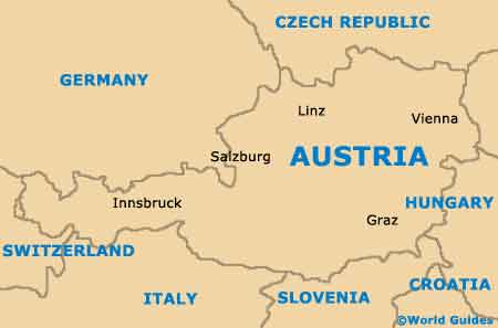
Vienna is located on the eastern side of Austria, within the state of the same name, where it is the country's premier city and one of the most densely populated in Europe. Well over one and a half million people now call Vienna their home, with the city being well-known for its high standard of living and proximity to the borders of both the
Czech Republic,
Hungary and Slovakia.
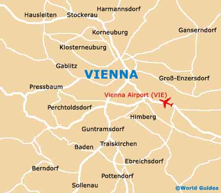
The city of Vienna comprises a total of 23 different districts. Many of the most interesting and historical sights are to be found within the Old City area, which is known as the Innere Stadt (District 1) and bounded by the Danube Canal. The north-eastern side of Vienna's Innere Stadt district contains a number of prominent boulevards and this region is named the Ringstrasse, often being simply referred to as the Ring.
Maps and Orientation of the City
Addresses in Vienna are usually easy to understand and find, and the building number is always shown directly after the actual street name. Worth noting, any number shown before the street name denotes the particularly district in which the building resides (1 to 23).
St. Stephen's Cathedral resides in the very heart of Vienna and is always a good landmark from which to gain your bearings, as are the main railway stations - Franz Josefs Bahnhof (north), Westbahnhof (west) and Südbahnhof (south). Maps of Vienna are available at the 'Information and Hotel Reservation' counters at the airport and the Westbahnhof train station. Free maps can also be obtained at the Tourist Info Zentrum outlet on the Am Albertinaplatz, and at the Jugend Info Wien (Vienna Youth Information Office) on the Babenbergerstrasse.
- Berndorf - 52 km / 32 miles (48 minutes, south-west)
- Bisamberg - 18 km / 11 miles (22 minutes, north)
- Bratislava (Slovakia) - 87 km / 54 miles (one hour and five minutes, east)
- Floridsdorf - 9 km / 6 miles (15 minutes, north)
- Graz - 200 km / 124 miles (two hours and 15 minutes, south-west)
- Guntramsdorf - 29 km / 18 miles (35 minutes, south)
- Hollabrunn - 53 km / 33 miles (50 minutes, north-west)
- Klosterneuburg - 13 km / 8 miles (20 minutes, north)
- Linz - 186 km / 116 miles (two hours and ten minutes, west)
- Melk - 88 km / 55 miles (one hour and ten minutes, west)
- Mistelbach - 51 km / 32 miles (48 minutes, north)
- Pressbaum - 31 km / 19 miles (35 minutes, west)
- St. Polten (Sankt Pölten) - 69 km / 43 miles (one hour, west)
- Stockerau - 28 km / 17 miles (30 minutes, north-west)
- Vosendorf - 19 km / 12 miles (25 minutes, south)
- Wiener Neustadt - 62 km / 39 miles (50 minutes, south)
Map of Austria
Map of Vienna